
Circuit Exploration Report: Checking out the CVT in Montgomery County

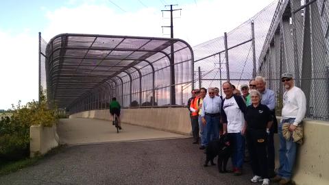

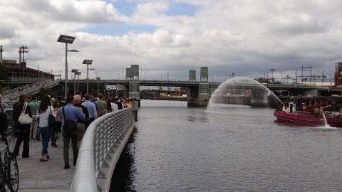
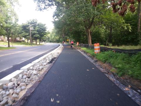
For most people, the caged bike/ped bridge over I-76 (as seen in the photo slide show) in King of Prussia is the closest they have ever gotten to the Chester Valley Trail (CVT) in Montgomery County.
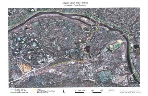
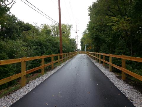
The bridge opened in 2004 when the I-76 and 202 interchange was upgraded. (The other trail bridge is Norfolk Southern's Trenton Cutoff.) And, slowly but surely, the Chester Valley Trail has been built to the west to meet Chester County's 13 miles of trail and in hopefully in two years, will extend eastward to meet up directly with the Schuylkill River Trail in Norristown.
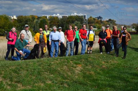
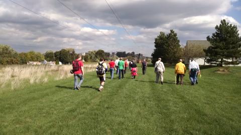
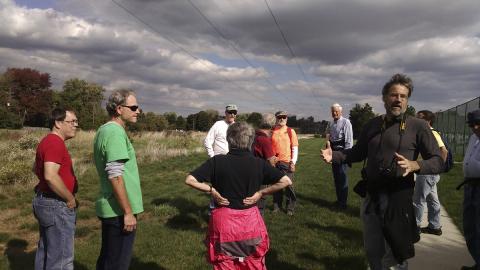
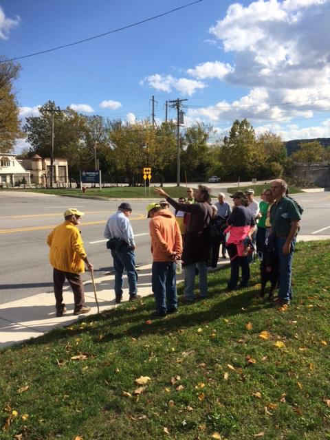
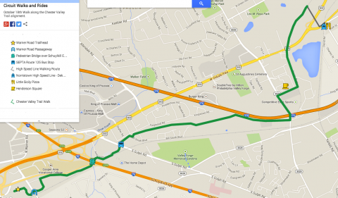
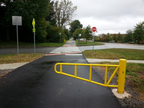
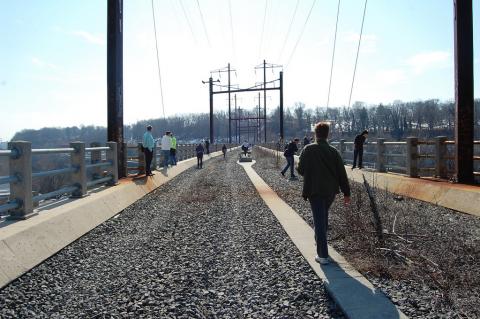
Currently, in Montgomery County, the eastern edge of the CVT is South Gulph Road and the westen end is at South Warner Road. As part of our "Explore the Circuit" series of rides and walks, on October 18th, about twenty of us joined Mike Stokes, Assistant Director of the Montgomery County Planning Commission to see how the county was going to align the Chester Valley Trail eastward to the SRT.
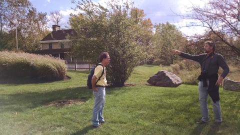
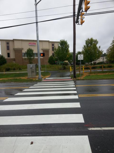
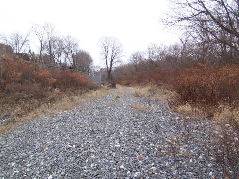
We set out on a beautiful windy afternoon from the S. Warner Road trailhead (nice parking lot with toilet facilities) and walked east, over the expressway to South Gulph Road. We then crossed over to Bill Smith (a former Supervisor) Boulevard and took a look at the historic King of Prussia Inn (which was moved years ago from its original location.) Afterwards, we walked through the (hugely wide) PECO right of way that the trail will go through and then along Hansen Access Road. Fortuitously, we had among our group a SETPA planner who told us that one of four possible alignments for the KOP trolley extension might also use the PECO ROW, but it won't interfere with the trail. At the junction of Hanson Access Road and Henderson Road, the trail will go over Henderson Road on second bike/ped bridge and land on an inactive rail line. The trail will continue up this old rail line and eventually meet up at DeKalb Street and cross the Schuylkill River on the DeKalb Bridge where it will meet with Schuylkill River Trail at the Norristown Transportation Center.
It was a lovely walk and everyone enjoyed learning more about this much anticipated connection between two Circuit trunk trails. Montco hopes to advertise the project in 2015 and estimates that the project will take one year to complete. The Bicycle Coalition hopes to return next spring and host another walk of the section from Henderson Road to Norristown. Many thanks to Mike Stokes for sharing his deep knowledge of the project, the map below and some of his photos.
Look for Rails to Trails Conservancy Trail Surveys #onthecircuit
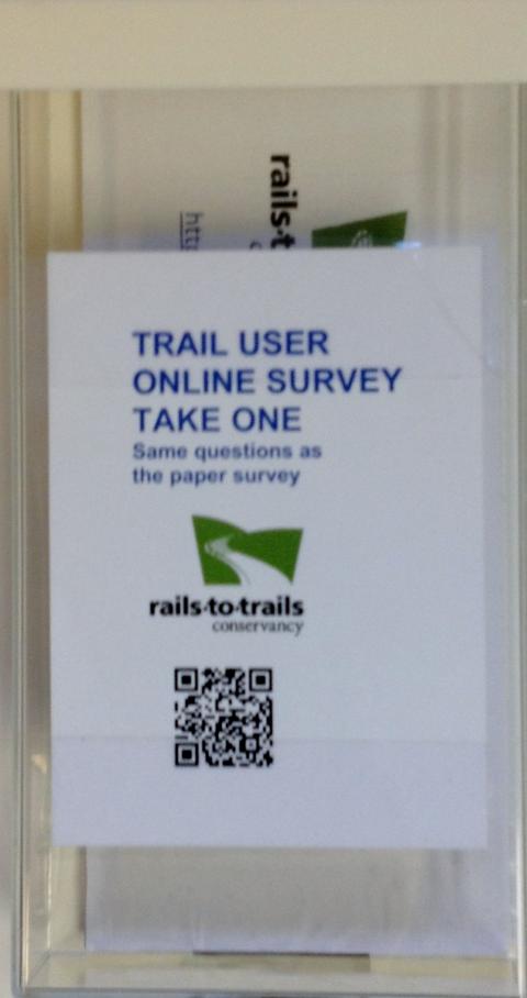
- Chester Valley Trail
- Cynwyd Heritage Trail
- Port Richmond Trail
- Perkiomen Trail
- Radnor Trail
- Route 202 Parkway Trail
- Schuylkill River Trail (Valley Forge area)
- Schuylkill River Trail (Fairmount Park area)
- Schuylkill River Trail (Schuylkill Banks area)
- Wissahickon Trail
- Blackwood Railroad Trail
- Cooper River Trail
- Elephant Swamp Trail
- Lawrence-Hopewell Trail
- Monroe Township Trail
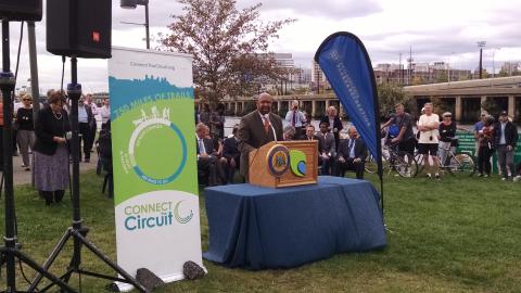
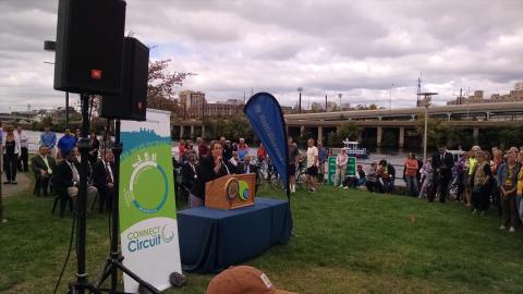
Pennsylvania Grants $2 million for the Circuit
On Friday, October 17th, Pennsylvania's Department of Conservation & Natural Resources announced $33 million in grants awarded through their Community Conservation Partnerships Program for trails, parks and open space. Ten awards (out of 219) were for Circuit trail projects, totalling $1,995,500. The ten projects included four for construction, five for planning, and one for acquisition. Listed below are the ten grants awarded to Circuit trails. Full list of all grants can be downloaded here
We offer a hearty congrats to all of our partners who received this funding! It's terrific and we are excited that so many worthy projects are going to be moving forward! And many thanks to our hardworking colleagues at DCNR for making these awards possible. Thank you DCNR!!!
CONSTRUCTION
Doylestown Township, $326,000, Development of the Neshaminy Creek Greenway Trail in New Britain Borough and New Britain and Doylestown townships, Bucks County. Work to include the construction of approximately 0.75 mile of trail and bridge to connect Upper State Road in Doylestown Township to the New Britain Train Station in New Britain Borough; ADA access, landscaping, project sign, and other related site improvements. Stephanie Mason, (215) 348-9915 ext. 1033.
Solebury Township, $500,000, Further development of the Route 202 Gateway Trail in Solebury Township, Bucks County. Work to include the construction of a 0.3-mile trail segment from the Route 202 Connector Road to Magill's Hill Park on Chapel Road in Solebury Township; ADA access, landscaping, project sign, and other related site improvements. Dennis H. Carney, (215) 297-5656.
Phoenixville Borough, $481,900, Further development of the Schuylkill River Trail in Phoenixville Borough, Chester County and Upper Providence Township, Montgomery County. Work to include the construction of approximately 0.2 mile of trail across the PA Route 29 Mont Clare Bridge to connect Phoenixville Borough to Upper Providence Township; ADA access, landscaping, project sign, and other related site improvements. Jean Krack, (610) 933-8801 ext. 111.
Philadelphia City, $400,000, Development of the Frankford Creek Greenway in Philadelphia City. Work to include construction of approximately 1.2 miles of trail from the intersection of Wheatsheaf Lane and Aramingo Avenue to the intersection of Lewis Street and Delaware Avenue in Philadelphia City; ADA access, landscaping, project sign, and other related site improvements. Robert Armstrong, (215) 683-0229.
PLANNING
Chester County, $50,000, Prepare a Trail Study to evaluate options to connect the Chester Valley Trail to the Struble and Brandywine trails in Downingtown Borough, Chester County; Caln, East Caln, East Bradford, West Bradford, and West Whiteland townships, Delaware County. Work to include a written, bound report. Brian E. Styche, (610) 344-6285.
Concord Township, $40,000, Prepare a Trail Study to evaluate the options to develop a 6-mile multi-use trail along the Octorara Railroad line in Concord Township and Chester Heights Borough, Delaware County. Work to include a written, bound report. Brenda L. Lamanna, (610) 459-8911 ext. 102.
Haverford Township, $45,000, Prepare a Trail Study to evaluate options to extend the Darby Creek Trail north to the Haverford Reserve and south to the Upper Darby Township line in Haverford Township, Delaware County. Work to include a written, bound report. Tim E. Denny, (610) 446-9397.
Clean Air Council, $30,000, Prepare a Trail Study to evaluate options to extend the Cobbs Creek Connector Trail - Segment B from the Blue Bell Inn at Woodland Avenue and Island Avenue to the Cibotti Recreation Center at 77th Street and Elmwood Avenue. Work to include a written, bound report. Nick Rogers, (215) 567-4004 ext. 110.
Schuylkill River Development Corporation, $50,000, Prepare a Trail Study to evaluate options for extending the Schuylkill River Trail along the eastern bank of the Schuylkill River from Christian Street to the Grays Ferry Crescent Trail at 34th Street in Philadelphia City, Philadelphia County. Work to include a written, bound report. Joseph R. Syrnick PE, tel:215-222-6030-ext.102
ACQUISITION
Montgomery County, $73,000, Payment toward the acquisition of three parcels totaling approximately 16 acres along Route 422 in Lower Pottsgrove Township, Montgomery County for open space and access to the Schuylkill River and proposed Schuylkill River Trail. Michael M. Stokes, (610) 278-3729.
Walk the Future Chester Valley Trail in Montco
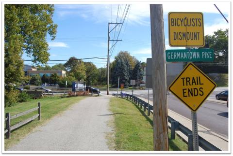
In Chester County, you can bike over 12 miles of off road trail in along Route 202, from approximately Warner Road to Exton. But, did you know that the Chester Valley Trail is going to connect all the way to the Schuylkill River Trail in Norristown? Currently, the trail is complete in Montgomery County only from Warner Road to South Gulph Road across I-76. Montgomery County Planning Commission has federal, state, and county funding in hand to build the trail from South Gulph Road across King of Prussia over the DeKalb Street Bridge to the Norristown Transportation Center. That project is in final design and should start in 2015.
We've asked Michael Stokes of Montgomery Planning Commission to lead us on guided walk of the alignment of the trail on Saturday, October 18th at 1pm. This walk will be approximately 8 miles long; from the Warner Road trailhead to Boro Line Road and back. (We aren't walking all the way to Norristown because a bridge over Boro Line Road is still under construction.)
This walk is free for Bicycle Coalition members and $20 for non-members (first year's membership is included). Please sign up here
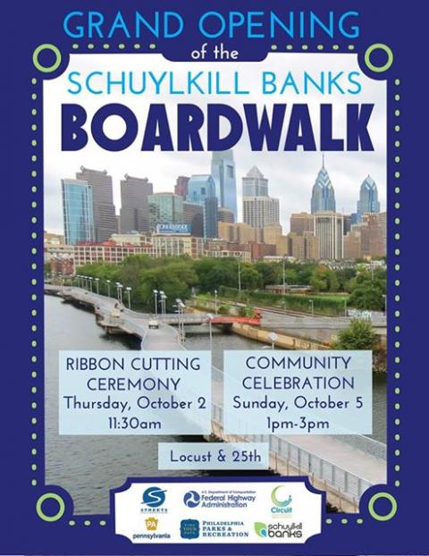
Boardwalk opens to great fanfare
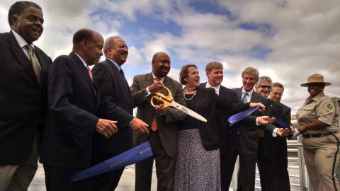


October 1st and 2nd were momentus days for Schuylkill Banks. A preview for 200 was held the evening of October 1st and the formal ribbon cutting on October 2nd. After eight years of planning, studying, designing, fundraising and construction, the Boardwalk opened to the delight of thousands who came to "walk on water."
The Boardwalk received high praise and extensive coverage. Links to most articles can be found on the Connect The Circuit's front page under "Circuit News." The AP story has a great quote from the Circuit Coalition's Vice Chair Patrick Starr
Patrick Starr, executive vice president of the Pennsylvania Environmental Council, said as he walked the trail that he didn't realize how much of a connection it made with the neighborhood.
"It transformed it into a great place that everybody wants to be at," said Starr, who is also involved with The Circuit, a network of 300 miles of trails in Pennsylvania and New Jersey. "It's opened a whole new playground for Philadelphians."
Chester County Officials Cut the Ribbon on Phase 3 of the CV Trail
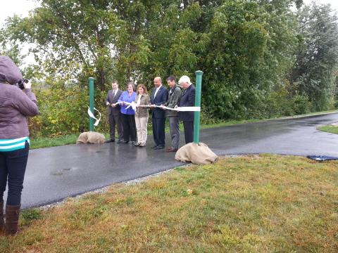
The wind and the rain did not dampen spirits at last week's ribbon cutting of of the Chester Valley Trail's phase 3 at Exton Park. County Commissioners, Bike Chester County, DCNR, West Whiteland Township and others were in attendence.
The new segment is only 3/4 mile long. But it connects the main trail to a long orphaned segment that stretches from Main St Exton to Iron Lake Rd and includes a pedestrian activated signalized crossing of Lincoln Highway (Business 30). As a result the trail has expanded to a length of 13 miles between Exton and King Of Prussia.
What makes the Chester Valley Trail so critical is that is in the County's main commercial corridor that is sandwiched between Route 202 and SEPTA's Paoli-Thorndale Line. As a result the trail provides a low stress non-motorized connection between the corridor's office complexes, retail establishments, residential developments and parks.
Chester County now is looking to expand further west. Design work to extend the tail up to the crossing of the Exton Bypass will begin next year. Meanwhile Montgomery County is part way through design for the four mile connection to the Schuylkill River Trail at the Norristown Transportation Center. Construction is expected to start in 2015. The Circuit Coalition will be hosting a walk through the future trail alignment on October 18. Bring your camera to take some before shots so you can brag that you walked it first.
Philadelphia Trail Symposium October 30
Trail Update – Building and Planning the Network in Philadelphia
What are the next big trail projects in Philadelphia? What is in store for trails near your house?
Hear the answers directly from City and non-profit development organizations that plan and build Philadelphia’s trail network. Staff from the Philadelphia City Planning Commission, Parks & Recreation, the Schuylkill River Development Corporation, the Delaware River Waterfront Corporation, and other entities will share updates on how trail projects are envisioned, prioritized and developed; which segments will be constructed next; and the vision for the citywide trail network.
Academy of Natural Sciences
5:30 – 6pm - Registration and Refreshments
6 – 7:30pm - Program
Have a Beer with the East Coast Greenway Riders
This is the fourth annual ride, and over a dozen people have been part of it since the first group left Calais, Maine in 2011. This year, four of the riders are from the Philadelphia area.
The first day’s ride, 49 miles to Wilmington, Del., includes part of the Circuit. The group will be among the first to ride along the new Schuylkill Banks Boardwalk, just ahead of the community celebration in the afternoon, and later in the day ride through the John Heinz National Wildlife Refuge.
Key events during the week include a Monday morning press conference and photo event with Delaware Gov. Jack Markell, a big supporter of trails, a Monday afternoon rally in Perryville, Md., in support of a bike-friendly crossing over the Susquehanna River, and a Wednesday Happy Hour with Annapolis, Anne Arundel county and state officials.
“Every year we get to know our communities and landmarks better, exploring the Eastern Seaboard at a pace that allows us to connect with the rich history, culture and nature of the region. We bring tens of thousands of tourism dollars to the communities we visit and aim to spur further greenway development toward a healthy and sustainable future transportation system,” said Dennis Markatos-Soriano, the East Coast Greenway Alliance’s executive director.
About 60 million people live within 25 miles of the East Coast Greenway, which receives an estimated 10 million visits each year. Many cities along the trail have a bike-friendly designation from the League of American Bicyclists – Philadelphia is one! -- and users can follow the route to commute to work and school, or to run errands, or to head out on longer adventures.
The creation of the East Coast Greenway has spurred officials at the state, county and local levels to create safer routes for pedestrians and bicyclists along the route as well as to connect to other trails, leveraging their value.
The East Coast Greenway Alliance, a non-profit organization based in Durham, N.C. that is coordinating the development of this greenway, has been organizing week-long rides along the route since 2011. The first Week-a-Year ride was from the Canadian border to Portland, Maine, and the goal is to finish in Key West in 2019.
Anyone interested in the 2015 ride can email the East Coast Greenway Alliance at [email protected]. More information about the East Coast Greenway is at www.greenway.org.
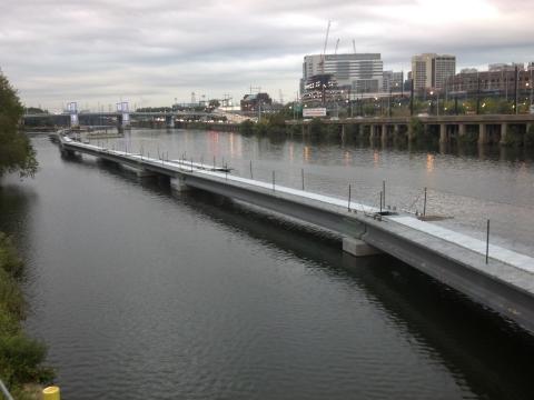
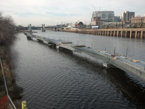
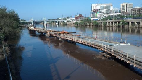
Time Lapse of Boardwalk Construction


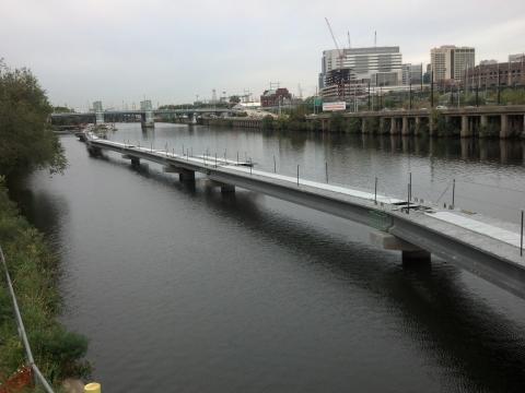


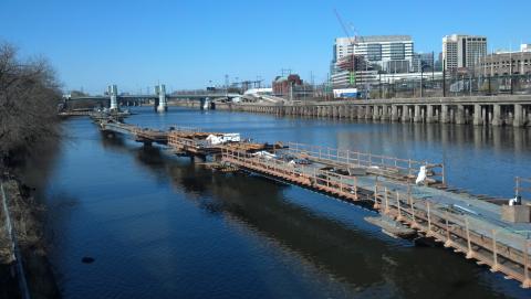
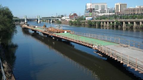
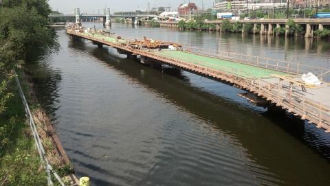
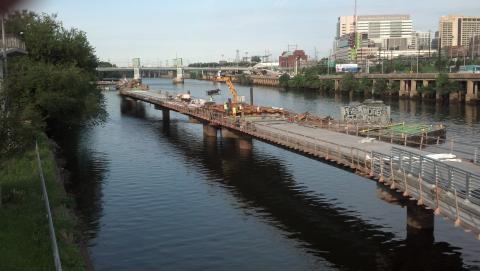
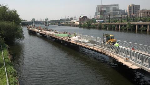
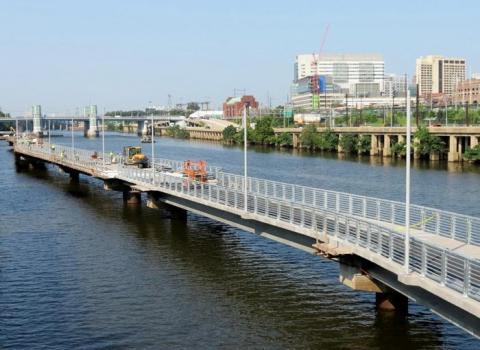
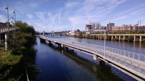
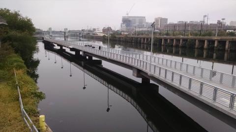
These pictures were taken from the lower overlook on the Connector Bridge. There is an image for each month over the course of the Boardwalk's construction starting in July 2013. See you at the ribbon cutting on October 2nd at 11:30am!
Upcoming DCNR Meetings
DCNR Statewide Comprehensive Outdoor Recreation Plan Public Meeting – October 7, 2014
DCNR is updating its strategic plan and we need to hear from Greater Philadelphia! Where should DCNR be making investments and building partnerships?
DCNR Grant Workshop – November 6, 2014
If you are thinking about applying for a grant from DCNR – you should attend! Learn about how the application process works and how to receive the best score possible.

PennDOT Accepting Applications for the 2015-2016 Multi-Modal Fund. But Hurry!
DCNR To Hold Public Meeting on Rec. Plan
What does the future hold for outdoor recreation in Pennsylvania? How will the state meet the demands of a growing and changing population, while maintaining and improving a vast and varied recreation infrastructure?
The PA Department of Conservation and Natural Resources and partners is in the process of updating Pennsylvania’s five-year outdoor recreation plan, and would like to hear what you think about the draft recommendations contained in the plan. Are we addressing your top recreation concerns and wishes? The feedback of those who live and work in urban areas is of particular importance in the development and implementation of the plan.
Please join representatives from DCNR for a public open house hosted by the Pennsylvania Horticultural Society on Tuesday, October 7, from 5 p.m. to 7:30 p.m. at the PHS Town Hall , 100 North 20th Street, first floor.
Stop by at 5 p.m. for some refreshments and a tour of the new PHS offices. DCNR will give a brief overview of the recreation plan at 5:30, and then invites you to visit five “priority stations” where you can learn more and provide your feedback.
Feel free to share this invitation with your staff, colleagues, board or members, as well as friends and family members of all ages. The more proponents of outdoor recreation that express their opinions, the better!
More information on the 2014-18 PA Outdoor Recreation Plan, including background and research findings, is available at www.paoutdoorrecplan.com.
The draft recommendations to be discussed at the public meeting will be posted on Oct. 6. Please RSVP by Friday, October 3rd.
Click here to register or call 215.988.1698.
Manayunk Bridge Construction Mobilization Update
Next to the Schuylkill Banks Boardwalk, the project that most trail enthusiasts are waiting for to kick off is the much anticipated construction of the trail over Manayunk Bridge. The contractor responsible for the Manayunk Bridge trail job, AP Construction, has been working since July (when the Notice to Proceed was issued by the Philadelphia Streets Department) on pre-construction tasks.
Before construction can begin, AP needs to remove contaminated soil, demolish a portion of bridge over the Norfolk Southern lilne and coordinate with SEPTA on fencing and other matters. They are making progress on all three fronts. Once complete, with those logistics, they can start regular construction.
AP has opened their field office on Green Lane.
Technical Assistance Grants Available
Here's an opportunity for those trail advocates who are working on a project that would benefit a K-8 school. We received this email from Safe Routes to School Partnership.
If you are working to make streets safer or to increase access to playgrounds and parks so that children and families in your community can have more opportunities for physical activity – we can help!
The Safe Routes to School National Partnership can assist your efforts to make your community a place where kids can easily be active and healthy. We are offering free technical assistance to successful applicants working in underserved communities on campaigns to obtain shared use agreements, Complete Streets policies, or other policies in support of walking, bicycling and Safe Routes to School.
Technical assistance can range from providing resources, to assisting with the creation of campaign plans and platforms, to developing communications strategies and coaching to ensure a successful campaign. Your plans can either be in the early stages or nearing policy adoption. Successful applicants will receive technical assistance over the next eight months.
How to Apply
Simply describe your community need in detail on the application form and our staff of experts will assess and work with each successful applicant to help you achieve your goals. Click here for more information.
Applications are due September 26th, 2014, by 5pm ET.
If you have any questions during the application process, please contact Mikaela Randolph, shared use campaign manager: .
Forge to Refuge & Cross County Public Meetings
Two Circuit trail segments are undergoing feasibility studies. Radnor Township is conducting the Forge to Refuge Trail (East and West) feasibility study and Plymouth Township/Montgomery County are jointly conducting the feasibility study for the Cross County Trail between Germantown Pike and Joshua Road. Both studies are contracted to Campbell Thomas & Company.
There are two upcoming meetings worth attending if you are interested in providing input on the alignment of these trails.
September 15th, 7pm - Forge to Refuge (East) - Bartram's Garden, Philadelphia
October 7th, 7pm - Cross County Trail - Greater Plymouth Community Center, 2910 Jolly Road, Plymouth Meeting, PA.
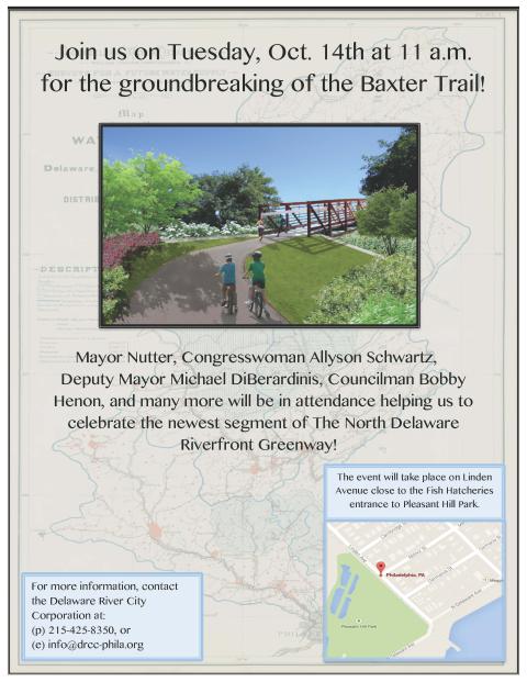
October Groundbreakings for Manayunk Bridge & Baxter Trail
The North Delaware Baxter Trail groundbreaking has been set for October 14th at 11am.
The Manayunk Bridge groundbreaking will occur October 28th at 11 am.
What Makes a Circuit Trail?
Are all trails in the Greater Philadelphia region part of the Circuit? Not necessarily. And not all trail segments that are on the Circuit web map are part of the Circuit. Those trail segments on the web map that are part of the Circuit are indicated so by the Circuit logo when scrolled over. In order to help clarify what makes a Circuit Trail, the Circuit Coalition steering committee adopted the following criteria.
- Trail is off-road (with some exceptions)
- 10 feet minimum, preferably 12 feet (with some exceptions)
- Multi-purpose
- Preferably paved (with some exceptions)
- Connects to already approved Circuit trails
- Submit letter and map addressed to Chris Linn [email protected]
- Chris will provide a recommendation for review to Circuit Coalition Steering Committee
Camden County Parks Widens the Cooper River Trail
Construction crews are finishing up the widening of the of the Cooper River Trail between Grove St and Colwell Ave in Cherry Hill.
The trail segment which connects Greenwald Memorial Park with Challenge Grove park was poorly marked and maintained. The pathway is now 10 feet wide and completes a walking loop between Haddonfield and Cherry Hill via the Evans Pond Dam and the sidewalk of Kings Highway.
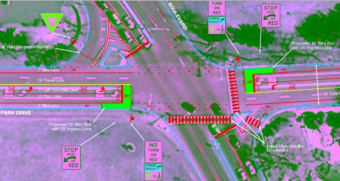
In other news the County has a submitted a Transportation Alternatives proposal for bike lanes on North Park Drive between Route 130 andthe east end of Park Drive near the NJ TRANSIT/Conrail underpass. The proposal as written in the Cooper River Park Safe Access plan includes the first bike lanes in the region with a buffer on the right to prevent dooring. The conceptual plan also proposes for bike boxes at Cuthbert Blvd. Transportation Alternatives funds are competitive so there is no guarantee that money for the bike lanes would be awarded this year.
West of Route 130 a short section of trail funded by the Regional Trails Program is nearing design completion and should go out for bid sometime later this year or perhaps early 2015.
Web favorites
- Non Gamstop Casinos
- Casino Not On Gamstop
- Non Gamstop Casinos
- Online Casinos Nederland
- Casinos Not On Gamstop
- Non Gamstop Casino
- UK Casinos Not On Gamstop
- Non Gamstop Casino UK
- Online Casinos
- Non Gamstop Casinos
- Non Gamstop Casinos UK
- オンライン カジノ おすすめ
- Casinos Not On Gamstop
- Non Gamstop Casinos
- Sites Not On Gamstop
- Non Gamstop Casino Sites UK
- Melhores Cassinos Online Com Bônus De Registo
- Casinos Not On Gamstop
- Casinos Not On Gamstop
- Casino Zonder Cruks
- Best Non Gamstop Casino
- Lista Casino Online Non Aams
- Sites Not On Gamstop
- Casino Non Aams
- Bitcoin Casinos
- Meilleur Casino En Ligne France
- Meilleurs Sites De Paris Sportifs Belgique
- Sites De Paris Sportifs Belgique
- Casino En Ligne Belgique
- Casino Non Aams
- Casino En Ligne Fiable
- Nouveau Casino En Ligne
- Casino En Ligne Argent Réel
- Nouveau Casino En Ligne Francais
- Casino Bonus Senza Documenti
- Meilleur Casino En Ligne France